
Nepal’s Mountain Communities Lost a Critical Early-Warning Tool After Washington Pulled the Plug
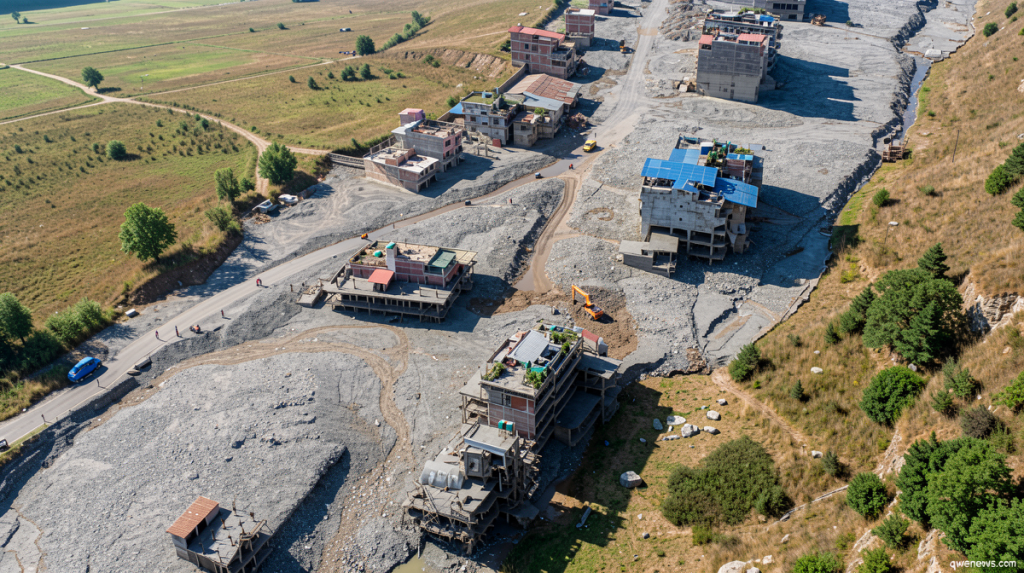
Qwenews.com – More than 1,100 people were killed on the morning of August 26 when a massive glacier rupture combined with a rock avalanche high in the Himalayas unleashed a torrent of floodwater that swept through valleys in both Nepal and China. The catastrophe has reignited a painful question: what monitoring infrastructure existed to give downstream residents even minutes of warning, and what was lost before the alarm could ever ring? The answer points back to January 2025, when the Trump administration severed funding for a decade-long natural-hazards monitoring effort in the Hindu Kush Himalaya region.
The program in question, Project SERVIR-Hindu Kush Himalaya, had been operating since 2010 as a joint venture among NASA, the US Agency for International Development (USAID), and the International Center for Integrated Mountain Development (ICIMOD). Its core mission was to map and continuously track zones where landslides, glacial outburst floods, and extreme-rainfall-triggered slope failures were most likely to occur. By building what its former director, Birendra Bajracharya, called “landslide situational awareness,” the project sought to give mountain communities a window of preparation before disaster struck.
A Sudden Halt to Work Underway Since 2010
Bajracharya recalled receiving a stop-work notice near the close of January 2025. The contract had been written to run through 2026, meaning roughly eighteen months of planned activity evaporated overnight. He explained that the abrupt termination left no runway to wind down field operations, transfer datasets, or hand instruments to successor organizations.
“We got the stop work notice around the end of January 2025,” Bajracharya said.
He added that slope-motion detection systems intended to feed landslide-forecast models were left unfinished, and that the capacity to correlate extreme rainfall events with slope instability was frozen mid-development. Flood inundation mapping, a tool that would have shown communities exactly which neighborhoods and farmland would be submerged in a worst-case scenario, is no longer operational.
The Mechanics of the Cut
Days after Donald Trump assumed the presidency, a sweeping executive order placed a hold on virtually all US foreign assistance worldwide. The freeze was followed by a broader dismantling of USAID, a process in which the Department of Government Efficiency (DOGE) played a central role. Scores of grants were canceled through automated keyword searches that flagged terms such as “climate,” effectively sweeping aside programs whose language matched the administration’s stated priorities on foreign aid.
A State Department spokesperson later told CNN that the January 2025 termination preceded the wider USAID reorganization and emphasized that Project SERVIR-Hindu Kush Himalaya’s tools and services remain active today through ICIMOD. The spokesperson also noted continued US backing for flood-mitigation work in Nepal. Bajracharya, however, attributed the cut directly to shifting administration priorities on foreign aid and to USAID reductions.
What Survived, What Did Not
Not every thread was severed. Bajracharya confirmed that streamflow prediction for major rivers in the region and forest-fire monitoring systems initiated under the project continue to function. The broader SERVIR network still runs programs across other parts of Asia, Africa, and Latin America, according to information posted on its website. But the Nepal-specific projects have been shut down.
On the question of whether the program could have warned residents of the August 26 flood, Bajracharya was candid: glacier breakup events are sufficiently rare that researchers have not yet developed reliable alarm thresholds for them. The project was instead working to identify locations where such events were statistically more probable, information that could help downstream communities harden infrastructure and plan evacuations. That preparatory work, he stressed, was exactly what the funding cut eliminated.
Remaining US Channels for Flood Preparedness
The State Department spokesperson outlined two continuing avenues of support. One is a grant to the World Meteorological Organization aimed at flood mitigation in Nepal. The other is a work agreement between the National Oceanic and Atmospheric Administration (NOAA) and Nepal’s Department of Hydrology and Meteorology covering flood early warning, disaster-response training, and improvements to forecast data quality.
Why the Himalaya Needs More Eyes, Not Fewer
The physics of a warming planet makes the monitoring gap especially acute in high-altitude terrain. Rising temperatures destabilize glaciers that have persisted for millennia, while simultaneously increasing the frequency and intensity of monsoon rainfall that saturates already-fragile slopes. The combined effect is a compounding risk of landslides, flash floods, and glacial lake outburst floods — precisely the hazard classes the SERVIR project was designed to track.
Marco Tedesco, a geophysicist at Columbia University, underscored that developing early-warning systems for landslides, glacier collapse, and river flooding in the Hindu Kush Himalaya remains an urgent scientific and humanitarian priority. The region’s population is growing, infrastructure is expanding into historically hazardous corridors, and the climate signal is strengthening year over year. Removing the monitoring layer that had been accumulating data since 2010, without advance notice or a transition plan, leaves communities in some of the most geologically active terrain on Earth with thinner information exactly when the threat landscape is widening.
The August 26 disaster will be studied for years. What it will also prompt, in policy circles and among the scientists who lost their instruments, is a reckoning over how quickly a single administrative decision can erase a decade of accumulated hazard knowledge — and how little time mountain villages get between the last satellite pass and the first wave of water.
Related Reading
Frequently Asked Questions
What is The Trump administration cut funds for natural?
The Trump administration cut funds for natural is the main topic of this guide. The article explains the context, practical details, and next steps readers should understand.
Why does The Trump administration cut funds for natural matter?
The Trump administration cut funds for natural matters because readers are looking for a useful answer, not just a short summary. Good content should match search intent and help them decide what to do next.