
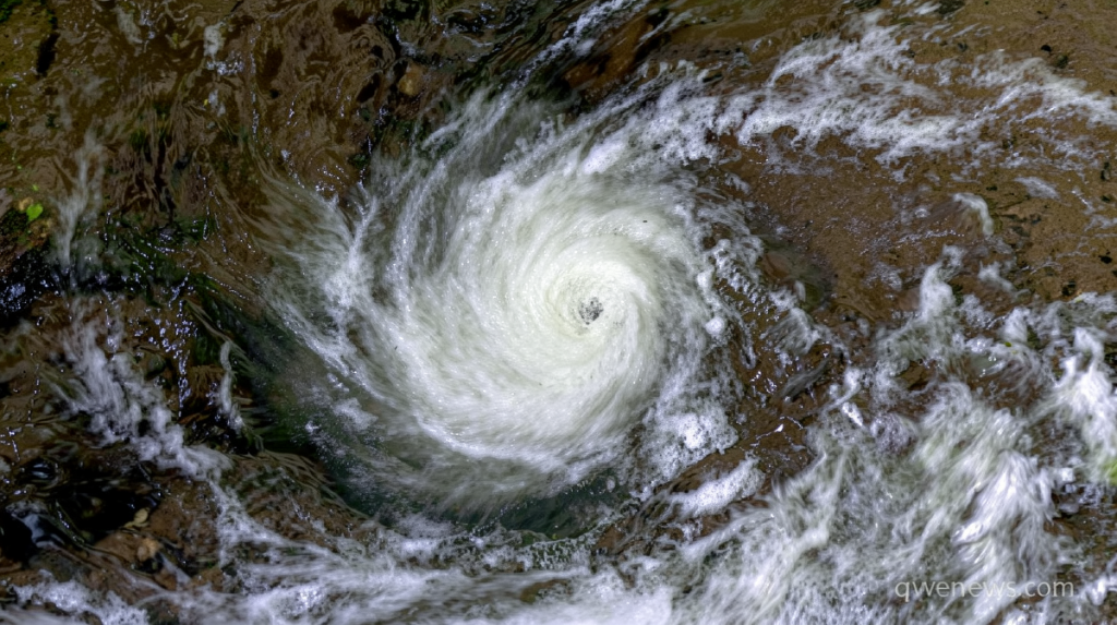
Hurricane Lowell strengthens to Category 5
Qwenews.com – Three weeks, three storms, and now a monster bearing down from the south. Governor Josh Green signed a state-of-emergency order covering every island in the chain on Thursday, unlocking state resources and authorizing activation of Hawaii National Guard units. The trigger: the storm, which had already punched through 160 mph winds by Friday evening local time, is forecast to swing north this weekend and pass within striking distance of Niihau and Kauai by Monday.
The declaration came amid a Pacific season that El Niño conditions have turned unusually violent. The system is the third tropical threat to menace the islands in roughly three weeks, following Hurricane Lala’s catastrophic rainfall on the Big Island in mid-August and the far weaker Tropical Storm Moke that brushed the same island in late August. Officials are now bracing for what they describe as a sustained autumn of threats rather than a single isolated event.
Storm Status and the Forecast Turn
The National Hurricane Center reported that the system briefly reached peak intensity on Wednesday before a temporary dip, only to rebuild to that level by Friday. Winds topped out at 160 mph. The center noted that “some additional intensification is possible over the next day or so, followed by a gradual weakening trend by early next week,” though the storm is expected to arrive near the islands at roughly Category 3 strength.
At present the hurricane is tracking westward, positioned more than 500 miles south of the Hawaiian chain. The critical variable is an upper-level low-pressure system well to the north. When that feature locks onto the storm’s circulation, the system will execute a sharp leftward turn toward the islands. The precise timing of that interaction, and how firmly the upper-level system grips the hurricane, will dictate both the timing of the turn and the closest approach to populated land.
The Iniki Parallel
The forecast track shares an unsettling resemblance to the path of Hurricane Iniki in 1992, which struck Kauai as a Category 4 and remains the most destructive storm in the state’s recorded history. Green did not mince words about the comparison.
“If (the storm) does what Iniki did in 1992 or even does anything close … we could see tragic consequences,” Green said.
Iniki’s landfall produced catastrophic wind damage, a tsunami-like surge, and multiple fatalities. The parallel underscores why even a Category 3 approach—let alone a stronger one—demands full-scale preparation across the western islands.
Wide Uncertainty, Narrow Window
The center’s official cone places the eye roughly 150 miles west of Niihau or 190 miles west of Kauai from late Monday afternoon through Monday night. Forecasters flagged below-normal confidence in that exact track because the storm has not yet completed its northward turn. Ensemble model groups continue to spread across a broad spectrum of outcomes: from a potentially devastating landfall on Kauai or Oahu to a pass more than 500 miles west of Niihau that would produce little beyond slightly elevated surf and scattered showers.
A shift of fewer than 100 miles eastward from the current forecast line would translate into substantially more direct impacts from a major hurricane. Confidence in the track is expected to sharpen considerably once the turn executes this weekend.
What Residents Should Expect
Even in the least-severe scenario, the outer circulation is powerful enough to churn the ocean surface over a vast radius, stacking up large swells that reach the islands before the center arrives. Rough surf, coastal flooding, and rip currents are likely beginning as early as this weekend, particularly along the western-facing shores of Kauai, Niihau, and Oahu.
State and county authorities have moved ahead of the storm. Kauai County crews began clearing drainage channels and staging flood-response equipment in historically vulnerable zones. At least two state parks on the island closed their camping areas, and land-and-natural-resources personnel were scheduled to notify any remaining campers to vacate immediately on Friday. Six high-water vehicles were dispatched to Kauai to support evacuation and rescue operations if needed.
Officials urged every resident to stock at least 14 days of food, water, medications, and other essentials before the system arrives.
Frequently Asked Questions
When will the storm reach the Hawaiian islands?
Forecasters project the system will pass within striking distance of Niihau and Kauai by Monday. The exact timing depends on when an upper-level low-pressure feature to the north completes its interaction with the storm’s circulation, a process expected to unfold over the weekend.
What should residents do right now?
Stock at least 14 days of food, water, medications, and essentials. Secure or bring indoors loose outdoor items. Monitor county emergency-management channels for evacuation orders. If you live in a coastal or low-lying area on the western islands, identify your evacuation route before the storm arrives.
How does this compare to Hurricane Iniki in 1992?
The forecast track resembles Iniki’s path, which struck Kauai as a Category 4 and caused catastrophic wind damage, a tsunami-like surge, and multiple fatalities. Current forecasts suggest the storm will weaken to roughly Category 3 by the time it reaches the islands, but officials are preparing for the worst-case scenario.
Is the state emergency declaration limited to one island?
No. Governor Green’s order covers every island in the Hawaiian chain, authorizing state-wide resource deployment and National Guard activation across the entire territory.