
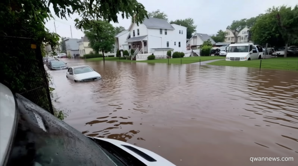
Storm Brings Flash Flooding to Northeast
Qwenews.com – Flood warnings issued for eastern New York and surrounding areas as a powerful weather system continues to dump heavy rain across the region. Communities from the Hudson Valley into New England face escalating dangers from rising waters, with numerous water rescues already underway and travel severely disrupted.
Record Rainfall Accumulates
Eastern New York has experienced hours of continuous downpours, with the Albany metropolitan area among the hardest hit locations. The Hudson Valley currently operates under multiple flash flood warnings as precipitation totals exceed six inches in several communities. Schodack leads regional measurements with an impressive 9.22 inches collected during this event—surpassing the typical monthly July average by more than double.
Albany International Airport has recorded over five inches of rainfall since Tuesday, ranking among the city’s most significant two-day precipitation events in its history. CNN affiliate WRGB captured dramatic footage showing vehicles trapped in rising floodwaters in Guilderland, a suburb situated just beyond Albany’s boundaries where numerous roadways have been shut down.
Video footage revealed a man carrying a child from one of the stranded vehicles while assisting another individual through water reaching waist depth.
Millions Under Watch
More than 11 million residents across the region remain under flood watch conditions extending from eastern New York through western New England. The highest threat level concentrates over portions of eastern New York, Massachusetts, Vermont, and Connecticut, where meteorologists have designated a Level 3 of 4 risk for flooding rainfall.
Continued heavy precipitation threatens to generate substantial and potentially dangerous flooding conditions. As Wednesday progresses, intense rain will gradually advance into eastern Massachusetts, encompassing the Boston metropolitan area. Southwest New England expects to receive between two and four inches of rainfall across most territories.
The National Weather Service has cautioned that the Berkshires and Worcester Hills could experience up to seven inches of precipitation, with mountainous topography enhancing moisture extraction from the atmosphere.
Rescue Operations Continue
Earlier in the storm’s progression, at least twenty individuals received assistance from floodwaters in the Paterson, New Jersey, region according to municipal fire officials. Among those saved was a person confined to a wheelchair who became isolated in rising water levels.
Just past midnight on Wednesday, the New Jersey Department of Transportation reported that two lanes of US 1/9 closed in both directions near Hudson County’s Pulaski Skyway due to flooding. The New York City Fire Department documented several vehicles becoming stranded on Staten Island during Tuesday evening hours.
Additional rescue efforts occurred across Pennsylvania and New Jersey on Monday and Tuesday. The Rescue Hose & Ladder Co. fire department in central Pennsylvania responded to Coalport, where emergency crews extracted three people and two dogs from a flooded home. In eastern Pennsylvania’s Reading area, five individuals including a young child required rescue after floodwaters overwhelmed their vehicle on a low-lying roadway, according to CNN affiliate WFMZ.
Aviation Disruptions Mount
Regional airports struggled to maintain operations amid the persistent downpours. Tuesday saw hundreds of flight cancellations throughout the New York City metropolitan area. By early Wednesday morning, FlightAware data indicated approximately 200 cancellations and dozens of delays combined across LaGuardia Airport, John F. Kennedy International Airport, and Newark Liberty International Airport.
Boston Logan International Airport experienced similar challenges, with more than thirty flights canceled and a comparable number delayed as of Wednesday morning.
Outlook for the Region
Heavy rain falling at rates between one and two inches per hour will continue affecting eastern New York and western New England through Wednesday afternoon. These zones face the highest probability of additional significant flooding throughout the day. Coastal New England, including Boston, will encounter bands of intense precipitation, though storms are expected to move rapidly enough to minimize serious flooding consequences.
The weather system will begin weakening by Wednesday evening, with rainfall becoming more dispersed and less intense. Consequently, the likelihood of widespread additional flooding will decrease. A Level 1 of 5 risk for isolated flooding rain extends from Boston to coastal Maine on Thursday, marking the tail end of this significant weather event.